A new measurement tool seeks to uncover how access to parks and other outdoor spaces can affect health outcomes for urban residents.
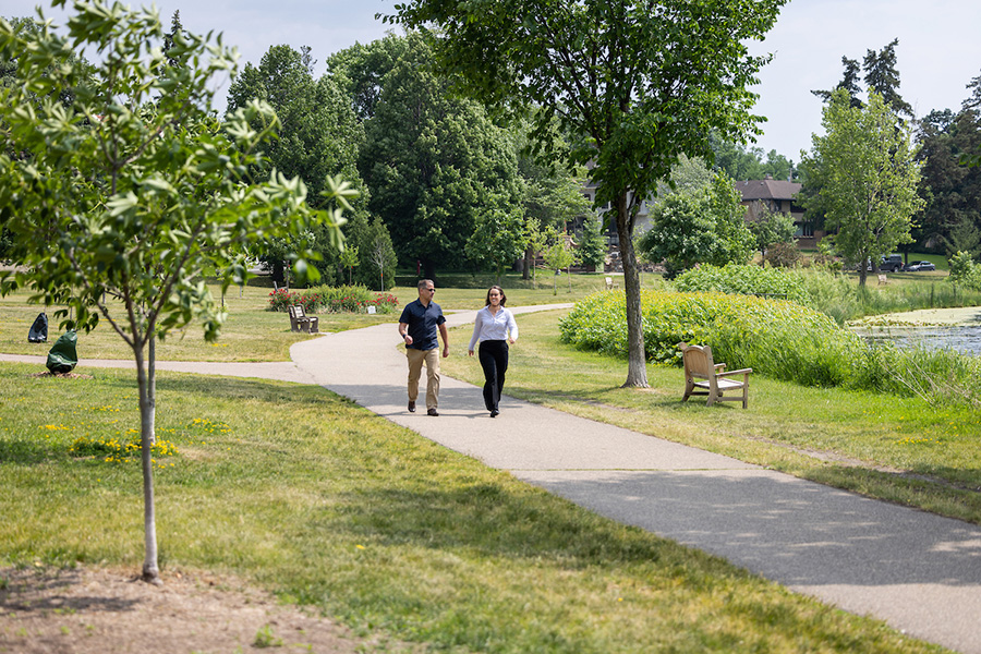
There’s growing evidence that access to green spaces improves health outcomes, which is good news for the Twin Cities of Minneapolis and St. Paul, whose park systems consistently rank among the best in the nation. The Twin Cities should, in theory, have higher overall health outcomes than most other cities, but that’s not the case, according to SPH Professor Mark Pereira. “The gaps in health outcomes across the rich and the poor, and the different racial and ethnic groups, are huge,” says Pereira, who is principal investigator on a new study to assess health and access to greenspace.
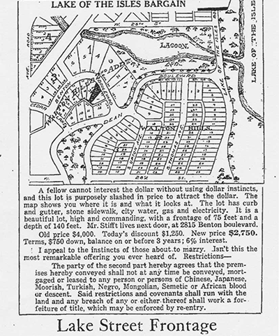
These disparities led Pereira and SPH doctoral student Christine Prissel to conceive of the Urban Greenspace Access Score (UGAS), a measurement system that quantifies neighborhoods’ access to green spaces. The study will test whether residents with limited access to the cities’ acclaimed green spaces have worse health outcomes than residents who have better access. This is especially relevant in a metropolitan area with a history of redlining, the discriminatory practice of denying residents of ethnic and religious minorities loans to buy homes in certain areas. Has the resulting segregation from racist housing practices left a legacy of poor health outcomes for residents decades later? Proving a connection between lack of green space and health with hard data is precisely what Pereira, Prissel, and their team of primary collaborators have set out to do in the study funded by three internal grants from the University of Minnesota.
Collaborating for Change
The project brings together multiple collaborators including U of M spatial engineering researchers, who informed the research design that involves state-of-the art satellite mapping techniques. The study map will identify the distribution of parks and access to public spaces, taking into account roadways and pedestrian paths. Jesse Berman, SPH assistant professor in Environmental Health Sciences, is providing an environmental exposure assessment to connect individual’s access to green space and resulting health effects.
Once the quantitative phase of research is complete, Pereira and Prissel will work with the Minneapolis Parks and Recreation Board (MPRB) to disseminate their findings to a broader audience and inform green space policy. Pereira and Prissel hope future iterations of their work will include interviewing local residents about their relationship to and utilization of green spaces. These personal stories and reflections will help tell a more complete story of access to green spaces.
A Template for Equitable Design
One consequence of redlining is that Minneapolis parks were not implemented equally across the city. The MPRB has a comprehensive plan to address these inequities through their current and future park planning. “Data helps us empirically reduce historic disparities, and is critically important for making the park system of the future work for everyone,” says Adam Regn Arvidson, director of strategic planning at the MPRB. “UGAS is nuanced, and provides an opportunity to go deeper and effect real change,” he adds.
“Data helps us empirically reduce historic disparities, and is critically important for making the park system of the future work for everyone.”
Adam Regn Arvidson
Ultimately, the UGAS team hopes that their research, which will be completed in mid-2024, will be used to better understand the relationships between access to green space and social determinants of health across the different areas of the Twin Cities. This has the potential to influence legislation that reduces the inequities around access to green space in the Twin Cities, and perhaps in the country. “UGAS will let us make the case with outside funders that change needs to happen,” says Arvidson.
“Both Mark [Pereira] and I are extremely committed to this project and the work of green space equity within the Twin Cities,” Prissel explains, adding that they plan to continue building relationships with their collaborators, and expanding the scope of the project nationally after the tool is developed and implemented in the Twin Cities.